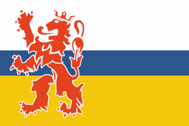
Limburg (Provincie Limburg)
 |
 |
Limburg's main municipalities are the provincial capital Maastricht (population 120,837 as of January 2022), Venlo (population 102,176) in the northeast, as well as Sittard-Geleen (population 91,760, bordering both Belgium and Germany) and Heerlen (population 86,874) in the south. More than half of the population, approximately 650,000 people, live in the south of Limburg, which corresponds to roughly one-third of the province's area proper. In South Limburg, most people live in the urban agglomerations of Maastricht, Parkstad and Sittard-Geleen.
Limburg's name derives from the Belgian fortified town of the same name, Limbourg-sur-Vesdre, now in the nearby Liège Province, immediately south of Limburg. The name of Limbourg-sur-Vesdre was important to the region because it had been the seat of the medieval Duchy of Limburg.
There are several proposals concerning the etymology of Limbourg. The second part, "bourg" or "burg" is common in placenames, and refers to a fortified town. The first part is often suggested to refer to lime or linden trees (species of Tilia). The historian Jean-Louis Kupper has proposed that its founder Frederick, Duke of Lower Lorraine named it after Limburg Abbey in Germany. He favours a derivation from a Germanic word "lint" meaning "dragon".
Ironically the area under the direct lordship of the old Duchy did not overlap at all with the modern Belgian and Dutch provinces named after it today, though the medieval Duchy was a high status title in the region. On the other hand, while the Duchy's effective power was limited, the Duchy and what is now South Limburg (referred to as Overmaas) did have a long history of connection under the lordship of the Dukes of Brabant. During this long period, from the Middle Ages until the French Revolution, they were sometimes referred to collectively under one name (Overmaas or Limburg).
After 1794, it was the French Republic which unified the region, along with Belgian Limburg, and removed all ties to the old feudal society (the ancien regime). The new name, as with all the names of the départements, was based on natural features such as rivers, in this case Meuse-Inférieure or Neder-Maas ("Lower Meuse").
After the defeat of Napoleon the newly created United Kingdom of the Netherlands desired a new name for this province. It was decided that the historic connection to the duchy of Limburg was to be restored, albeit only in name.
Map - Limburg (Provincie Limburg)
Map
Country - Netherlands
 |
 |
The four largest cities in the Netherlands are Amsterdam, Rotterdam, The Hague and Utrecht. Amsterdam is the country's most populous city and the nominal capital. The Hague holds the seat of the States General, Cabinet and Supreme Court. The Port of Rotterdam is the busiest seaport in Europe. Schiphol is the busiest airport in the Netherlands, and the third busiest in Europe. The Netherlands is a founding member of the European Union, Eurozone, G10, NATO, OECD, and WTO, as well as a part of the Schengen Area and the trilateral Benelux Union. It hosts several intergovernmental organisations and international courts, many of which are centred in The Hague.
Currency / Language
| ISO | Currency | Symbol | Significant figures |
|---|---|---|---|
| EUR | Euro | € | 2 |
| ISO | Language |
|---|---|
| NL | Dutch language |
| FY | West Frisian language |


